Top Links
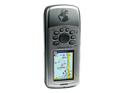
Garmin - Garmin GPSMAP 76CSx
GPS navigator - marine, hiking 2.6 in
Garmin
010-00469-01
N/A
N/A
N/A
New
Product Description
Additional Details
What's Included
| Main Specifications | |
|---|---|
| Product Description | Garmin GPSMAP 76CSx - GPS navigator |
| Product Type | GPS navigator |
| Display | 2.6" color - 160 x 240 pixels |
| Recommended Use | Marine, hiking |
| Preloaded Maps | Europe, Africa, Middle East, Western Russia |
| Interface | Serial, USB, NMEA 0183, RTCM SC-104 DGPS |
| Internal Memory | 115 MB |
| Receiver | 12-channel |
| SBAS | WAAS |
| DGPS | DGPS ready |
| Features | Digital compass, barometric altimeter |
| Tracking Data | Elevation, ascent/descent rate |
| Included Software | MapSource Trip & Waypoint Manager, MOB (Man Overboard) |
| Card Reader | microSD |
| Protection | Waterproof |
| Included Accessories | PC cable, lanyard, 128 MB microSD Card |
| Dimensions (WxDxH) | 2.7 in x 1.4 in x 6.2 in |
| Weight | 7.62 oz |
| General | |
| Product Type | GPS navigator |
| Recommended Use | Marine, hiking |
| Preloaded Maps | Europe, Africa, Middle East, Western Russia |
| Receiver | 12-channel |
| Card Reader | microSD |
| Interface | Serial, USB, NMEA 0183, RTCM SC-104 DGPS |
| Tracking Data | Elevation, ascent/descent rate |
| Included Software | MapSource Trip & Waypoint Manager, MOB (Man Overboard) |
| Compatible Software | MapSource BlueChart, MapSource US TOPO 24K, MapSource Fishing Hot Spots, MapSource Recreational Lakes, MapSource US TOPO, MapSource City Navigator |
| Grids | UTM, MGRS, Lat/Lon, User, Loran TDs, Maidenhead |
| SBAS | WAAS |
| DGPS | DGPS ready |
| Antenna | Built-in |
| Accuracy | Position - 49 ft ¦ Position - 10 ft - 16 ft (with DGPS) ¦ Position - 10 ft (with WAAS) ¦ Velocity - 0.16 ft/sec |
| Update Rate | 1/second |
| Internal Memory | 115 MB |
| Features | Digital compass, barometric altimeter |
| Miscellaneous | |
| Protection | Waterproof |
| Waterproof Standard | IPX7 |
| Included Accessories | PC cable, lanyard, 128 MB microSD Card |
| Environmental Parameters | |
| Min Operating Temperature | 5 °F |
| Max Operating Temperature | 158 °F |
| Battery | |
| Type | AA type |
| Required Qty | 2 |
| Run Time (Up To) | 20 hours |
| Display | |
| Type | LCD - color |
| Diagonal Size | 2.6" |
| Display Resolution | 160 x 240 pixels |
| Display Illumination | Yes |
| Connections | |
| Interfaces | Serial - RS-232 ¦ Serial - USB ¦ Antenna - MCX |
| Dimensions & Weight | |
| Width | 2.7 in |
| Depth | 1.4 in |
| Height | 6.2 in |
| Weight | 7.62 oz |
| Acquisition Times | |
| Warm | 15 sec |
| Cold | 45 sec |
| Navigation | |
| Waypoints | 1000 |
| Tracks | 20 |
| Tracklog Points | 10000 |
| Routes | 50 |
| Waypoints per route | 250 |
| Trip Computer | TracBack, average speed, maximum speed, trip timer, trip distance, sunrise/sunset times, sun/moon positions |