Garmin - Garmin Dakota 20
GPS navigator - hiking 2.6 in
Garmin
010-00781-01
0753759094874
N/A
New
Product Description
Outdoor navigation meets touchscreen simplicity in Dakota 20. This rugged, palm-sized navigator combines touchscreen navigation, high-sensitivity GPS with HotFix satellite prediction, barometric altimeter, 3-axis electronic compass and microSD card slot in one affordable, power-packed punch.
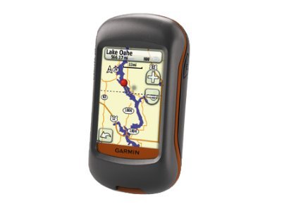
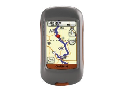
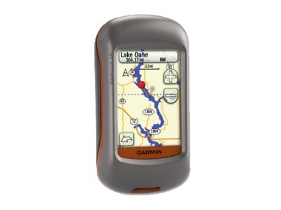
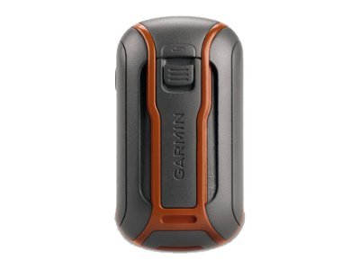
Dakota 20 makes outdoor navigation effortless with a tough, sunlight-readable, 2.6-inch color touchscreen display. The interface is easy to use, so you'll spend more time enjoying the outdoors and less time searching for information. Both durable and waterproof, Dakota 20 is built to withstand the elements: bumps, dust, dirt and water are no match for this rugged navigator.
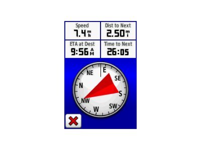
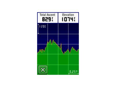
Dakota 20 has a built-in 3-axis electronic compass, which shows your heading even when you're standing still or not holding the device level. Its barometric altimeter tracks changes in pressure to pinpoint your precise altitude, and you can even use it to plot barometric pressure over time, which can help you keep an eye on changing weather conditions. And with its high-sensitivity, WAAS-enabled GPS receiver with HotFix satellite prediction, Dakota 20 locates your position quickly and precisely and maintains its GPS location even in heavy cover and deep canyons.
Get into paperless geocaching with Dakota 20 by quickly downloading up to 2,000 caches, with information such as location, terrain, difficulty, hints and description - no more paper print outs and manually entered coordinates.
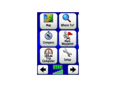
Touch and go
Dakota 20 makes outdoor navigation effortless with a tough, sunlight-readable, 2.6-inch color touchscreen display. The interface is easy to use, so you'll spend more time enjoying the outdoors and less time searching for information. Both durable and waterproof, Dakota 20 is built to withstand the elements: bumps, dust, dirt and water are no match for this rugged navigator.
Get your bearings
Dakota 20 has a built-in 3-axis electronic compass, which shows your heading even when you're standing still or not holding the device level. Its barometric altimeter tracks changes in pressure to pinpoint your precise altitude, and you can even use it to plot barometric pressure over time, which can help you keep an eye on changing weather conditions. And with its high-sensitivity, WAAS-enabled GPS receiver with HotFix satellite prediction, Dakota 20 locates your position quickly and precisely and maintains its GPS location even in heavy cover and deep canyons.
Find fun
Get into paperless geocaching with Dakota 20 by quickly downloading up to 2,000 caches, with information such as location, terrain, difficulty, hints and description - no more paper print outs and manually entered coordinates.
| Main Specifications | |
|---|---|
| Product Description | Garmin Dakota 20 - GPS navigator |
| Product Type | GPS navigator |
| Display | 2.6" color - 160 x 240 pixels |
| Input | Touch sensitive screen |
| Recommended Use | Hiking |
| Interface | USB |
| Internal Memory | 850 MB |
| SBAS | WAAS |
| Features | Digital compass, altimeter, barometric altimeter |
| Included Software | Tide Tab |
| Card Reader | microSD |
| Protection | Waterproof |
| Included Accessories | Lanyard, USB cable |
| Dimensions (WxDxH) | 2.2 in x 1.3 in x 3.9 in |
| Weight | 5.26 oz |
| General | |
| Product Type | GPS navigator |
| Recommended Use | Hiking |
| Card Reader | microSD |
| Interface | USB |
| Included Software | Tide Tab |
| SBAS | WAAS |
| Antenna | Built-in |
| Internal Memory | 850 MB |
| Features | Custom POIs, automatic routing, hunt/fish calendar, Garmin HotFix, Geocaching, digital compass, altimeter, barometric altimeter |
| Miscellaneous | |
| Design Features | Rugged case |
| Protection | Waterproof |
| Waterproof Standard | IPX7 |
| Included Accessories | Lanyard, USB cable |
| Battery | |
| Type | AA type |
| Required Qty | 2 |
| Display | |
| Type | TFT - color - touch sensitive screen |
| Diagonal Size | 2.6" |
| Display Resolution | 160 x 240 pixels |
| Display Illumination | Yes |
| Features | Anti-glare, transflective |
| Connections | |
| Interfaces | USB |
| Dimensions & Weight | |
| Width | 2.2 in |
| Depth | 1.3 in |
| Height | 3.9 in |
| Weight | 5.26 oz |
| Navigation | |
| Waypoints | 1000 |
| Tracks | 200 |
| Tracklog Points | 10000 |
| Routes | 50 |
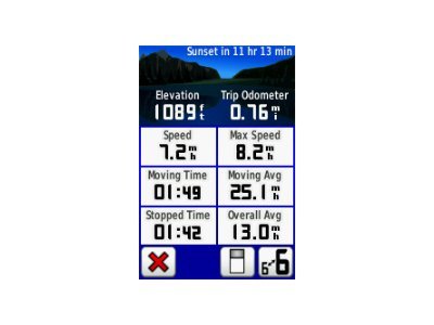
| Trip Computer | Sunrise/sunset times, sun/moon positions |